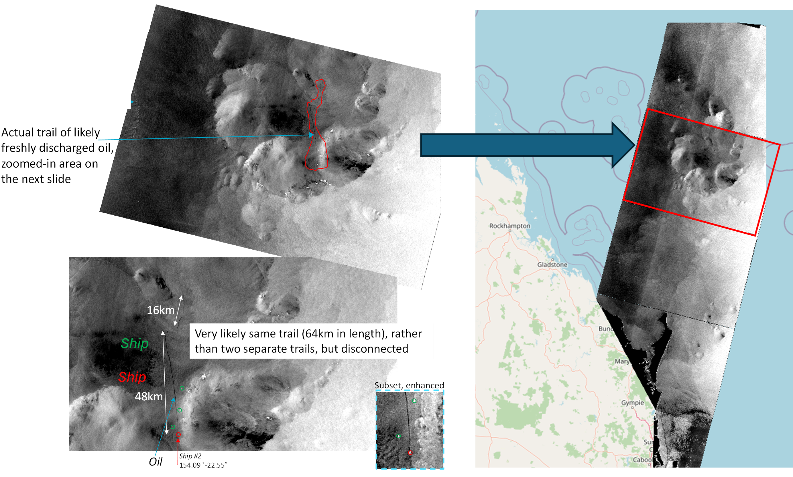
The potential for oil spills, or illegal discharges in the marine park from ships transiting through GBR waters is a significant risk that requires early detection and ongoing situational awareness. The most prominent oil spill in the marine park occurred in March 2009 with the Pacific Adventurer cargo ship due to encountering severe weather conditions during Cyclone Hamish. Over the past seven years however, several instances of likely illegal discharges from passing ships have been identified in the GBR.
An oil features detection system was developed as part of eReefs. Oil features floating on the ocean’s surface are best detected using Synthetic Aperture Radar (SAR) satellite scenes. The workflow system primarily targets possible illegal oil discharges from passing ships, but it is used for monitoring ports and the GBR waters to assist GBRMPA in managing this environmental risk.

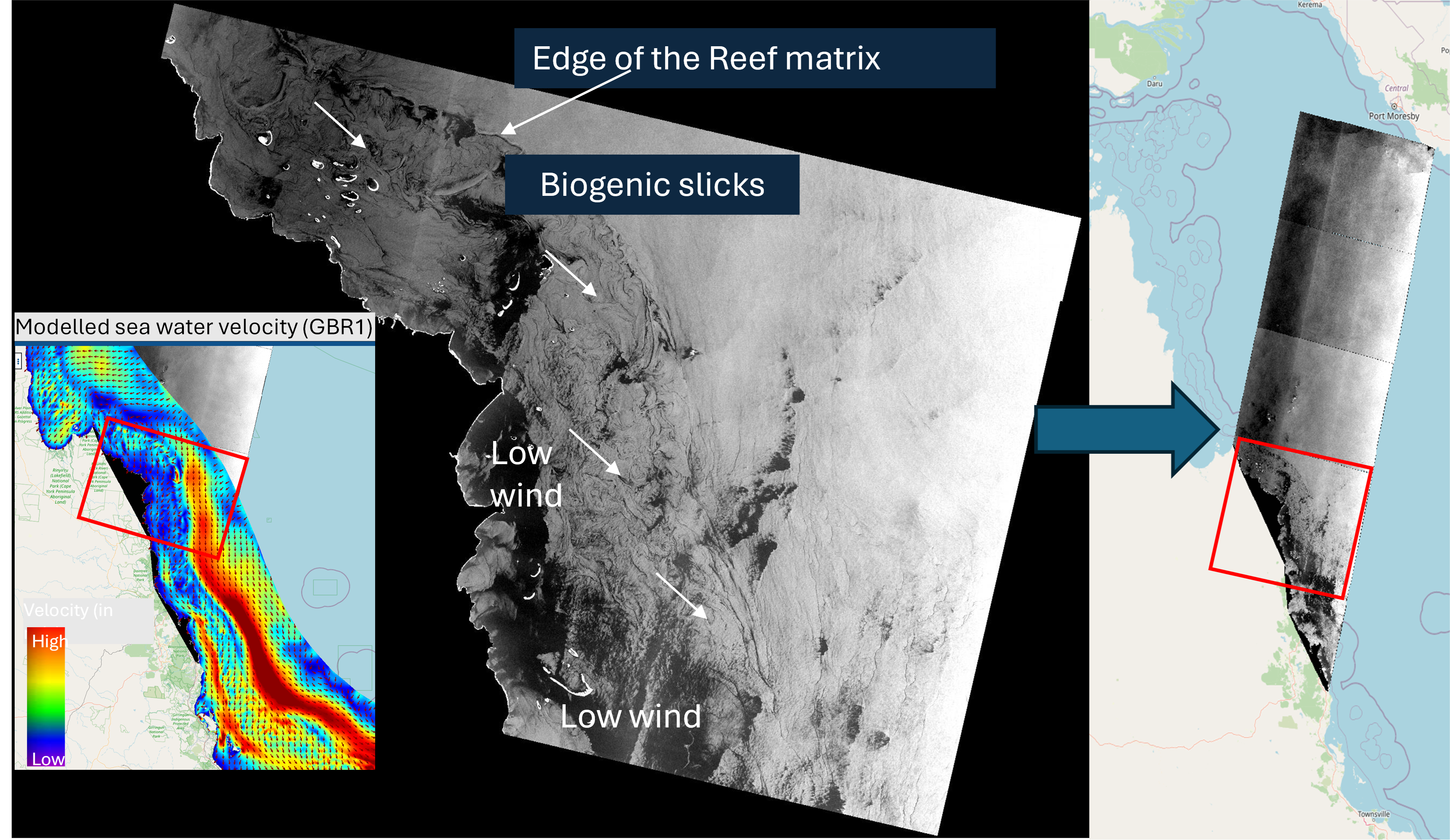
The system is semi-automated: the download, processing and detection assessment is running daily, but a trained operator provides a final assessment when a detection occurs prior to informing partner agencies such as the GBRMPA. More than 900 scenes are acquired annually, and processed, over the GBR since 2014. The system uses first a machine learning (ML) approach specifically trained for the GBR to detect potential features resembling oil slicks floating on the ocean’s surface in each scene. A second, empirical approach is then used to further discriminate potential candidate features from false positives. The system shows that it is reliable for ongoing background monitoring of the GBR resulting in 98% detection accuracy. Email alerts are sent to provide information on the number of SAR scenes processed on the day and possible features detected, thus allowing for further inspection by an operator if required. In addition, this new satellite information provides users with the ability to use various layers in synergy, such as ocean colour observations or hydrodynamic models, thus enhancing their understanding of the various processes and features observed in the GBR, as illustrated below.

Regular updates are provided to the relevant agencies (namely GBRMPA and AMSA) within a few hours (during weekdays) of detecting an oil spill (about 2 to 3 per year).
Related Resources
Blondeau-Patissier, D. Schroeder, T. Suresh, G. Li, Z. Diakogiannis, F. Irving, P. Witte, C. Steven, A. (2023). Detection of marine oil-like features in Sentinel-1 SAR images by supplementary use of deep learning and empirical methods: Performance assessment for the Great Barrier Reef marine park. Marine Pollution Bulletin, 188. 10.1016/j.marpolbul.2023.114598
Blondeau-Patissier, D. Schroeder, T. Diakogiannis, F. Li, Z. (2022). CSIRO Sentinel-1 SAR image dataset of oil- and non-oil features for machine learning ( Deep Learning ). 10.25919/4V55-DN16 https://data.csiro.au/collection/csiro%3A57430v1
Blondeau-Patissier, D. Schroeder, T. Irving, P. Witte, C. Steven, A. (2020). Satellite detection of oil spills in the Great Barrier Reef using the Sentinel-1, -2 and -3 satellite constellations - A technical assessment of a synergistic approach using SAR, optical and thermal information. CSIRO. 10.25919/5E46E030E3029 https://publications.csiro.au/publications/publication/PIcsiro:EP197797