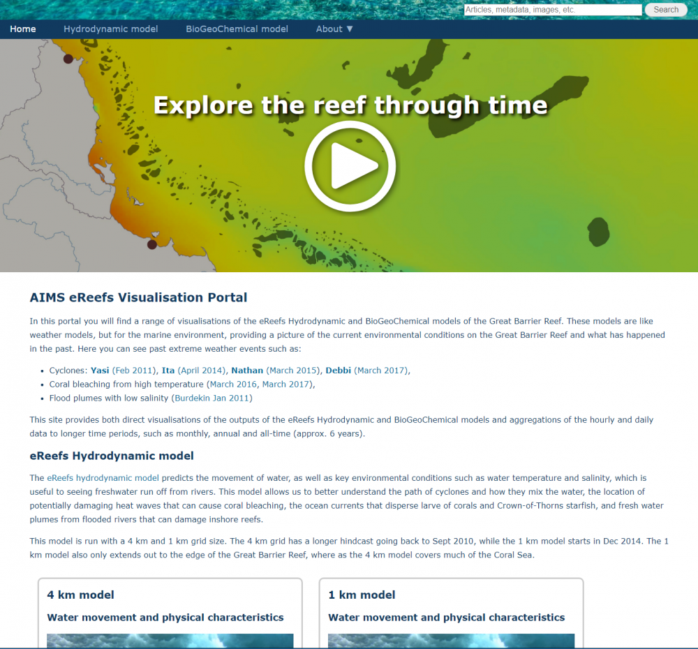
Powered by eReefs!
These web applications are the main interactive components of the eReefs web platform, and allow you to discover, visualise and explore eReefs and related datasets:
Decommissioned Web Applications
The following tools were once part of eReefs but have reached the end of their lifespans and are no longer available online.
ReefTemp Next Generation
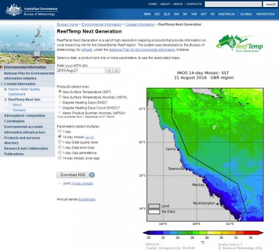
The ReefTemp Next Generation Website was an operational high-resolution daily satellite sea surface temperature (SST) monitoring tool for the Great Barrier Reef.
It was created and hosted by the Bureau of Meteorology, launched in October 2013, and used high-resolution SST data produced by the Intergrated Marine Observing System (IMOS) to produce maps of:
- Daily Sea Surface Temperature (SST)
- SST Anomalies (deviation from average SST)
- Degree Heating Days (thermal stress accumulation over summer)
- Mean Positive Summer Anomaly (Average thermal stress over summer)
These data products and maps were used on a daily to weekly basis year-round by the Great Barrier Reef Marine Park Authority (GBRMPA) to manage coral bleaching risk on the reef.
The ReefTemp Next Generation website was decommissioned in 2024 when the Bureau of Meteorology stepped back from active participation in the eReefs collaboration, but the IMOS SST data remains freely available online, and is available for visualisation in the eReefs Data Explorer (search for layers with names including ‘GHRSST’).
Archived information about ReefTemp Next Generation:
- ReefTemp Next Generation - Illustration
- About ReefTemp Next Generation
- ReefTemp Next Generation - CAWCR Technical Report No. 063
- Operational Implementation of ReefTemp Next Generation
Marine Water Quality Dashboard
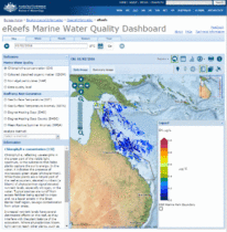
The eReefs Marine Water Quality dashboard was an interactive website that enabled access to a range of water-quality indicators for the Great Barrier Reef. It used near real-time data, and more than ten years of records of sea surface temperatures, chlorophyll levels, suspended sediments, and dissolved organic matter. Data from the Dashboard could be displayed in different formats (map, table or chart) and downloaded for further analysis and interpretation.
This website was created and hosted by the Bureau of Meteorology, and was released with some fanfare in March 2014.
The remote sensing data products available via the Marine Water Quality dashboard included ocean colour datasets derived from observations made by the MODerate resolution Imaging Spectrometer (MODIS) sensor on board the NASA Aqua satellite, using an algorithm developed by CSIRO.
These datasets were updated in near-real-time mode by the Bureau of Meteorology for several years, while the CSIRO remote sensing team worked to migrate the ocean colour algorithm to work with alternate instrument datasets, since the MODIS AQUA instrument was already well past its design lifespan by 2015 and expected to cease operation by 2017. (It ended up living much longer than that, of course, but we didn’t know that at the time!)
By December 2020 the MODIS ocean-colour operations were no was no longer generating accurate results due to an increasing mismatch between the CSIRO ocean colour algorithm and the instrument’s current calibration. New versions of the algorithm were designed for the ESA Sentinel-3A and -3B OLCI instruments and so the MODIS-based datasets were stopped, and the Marine Water Quality dashboard was decommissioned.
Archived information about the eReefs Marine Water Quality Dashboard:
- eReefs Marine Water Quality Dashboard - Illustration
- eReefs Marine Water Quality Dashboard - Information Sheet
- eReefs Marine Water Quality Dashboard - FAQs
- eReefs Marine Water Quality Dashboard - the Science
- eReefs Marine Water Quality Dashboard - Data Processing Specification
- eReefs Marine Water Quality Dashboard - Data Product Specification
- eReefs Marine Water Quality Dashboard - Scientific References
- eReefs Marine Water Quality systems - Known issues and planned improvements