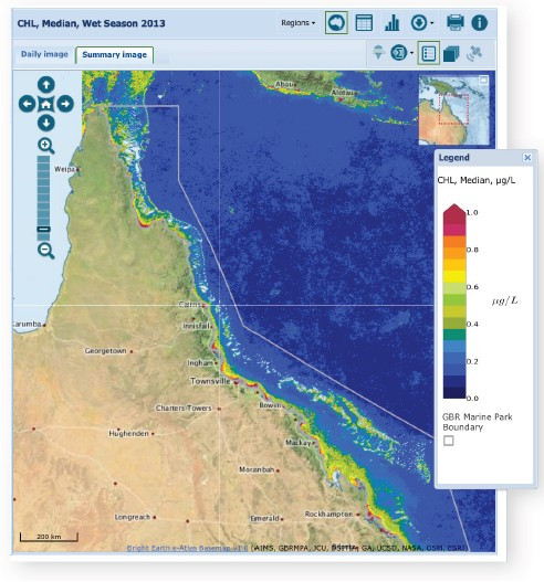
Remote sensing is now recognised as a suitable and cost-effective technique for describing and quantifying aspects of water quality on the Great Barrier Reef. Satellites provide time series from November 2002 to present of water quality estimates (Ocean Colour) with spatial coverage at 1 km resolution for the whole-of-GBR lagoon, nominally on a daily basis. Coastal waters are optically complex and global algorithms have been found to be of limited use. CSIRO have developed regionally valid algorithms that incorporate the regional and seasonal knowledge of optical properties of GBR waters.
The Ocean Colour dataset consists of processed satellite imagery, currently from the MODIS Aqua satellite and in the future from the VIIRS satellite (eReefs Phase 2). The image processing uses multiple algorithms developed by NASA, the CSIRO and other agencies and is now housed at the Bureau of Meteorology’s National Meteorological and Oceanographic Centre (NMOC) under the Marine Water Quality Dashboard.
The Dashboard enables access to near real-time data on sea surface temperatures, chlorophyll levels, sediments and light for the entire Great Barrier Reef and supplements existing data measurements. Data from the Dashboard can be displayed in different formats or downloaded from the web for further analysis and interpretation.
Marine Water Quality Dashboard brochure